Google Launches FireSat: AI-Powered Satellites to Detect Wildfires in Near Real Time
Share
New constellation to spot fires as small as 5×5 meters and revolutionize emergency response with 20-minute updates.
When wildfires threatened Juliet Rothenberg’s California neighborhood four years ago, all she and her family could do was wait. Satellite images—updated only twice a day—offered no real answers. The skies were red with smoke, and information was scarce.
“We had no idea if our neighbourhood was safe,” says Rothenberg, now Product Director of Climate AI at Google Research. “The experience really drove home how broken our current wildfire detection systems are.”
That personal crisis has now helped inspire a cutting-edge solution: FireSat, a constellation of AI-powered satellites developed by Google Research in partnership with the Earth Fire Alliance, the Gordon & Betty Moore Foundation, and Muon Space.
AI in Orbit: Wildfire Detection from Space
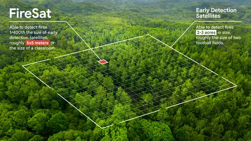
In March 2025, the first FireSat launched aboard SpaceX’s Transporter-13 mission from Vandenberg Space Force Base. It’s the first in a planned constellation of more than 50 satellites designed to detect wildfires just 5×5 meters in size, using high-resolution multispectral imagery and advanced AI models.
Unlike traditional satellites that update every 6–12 hours, FireSat delivers new high-res images every 20 minutes. This gives emergency responders critical time to act before fires escalate. The onboard AI compares fresh imagery with thousands of previous captures, accounting for weather, terrain, and atmospheric conditions to assess whether a fire is present.
“Some satellites take images every five minutes,” says Chris Van Arsdale, Chairman of the Earth Fire Alliance and Google Research team member, “but the resolution is so coarse, you’re lucky to spot a city—let alone a small fire. FireSat changes that.”
Tackling Fires Where Drones and Planes Can’t Reach
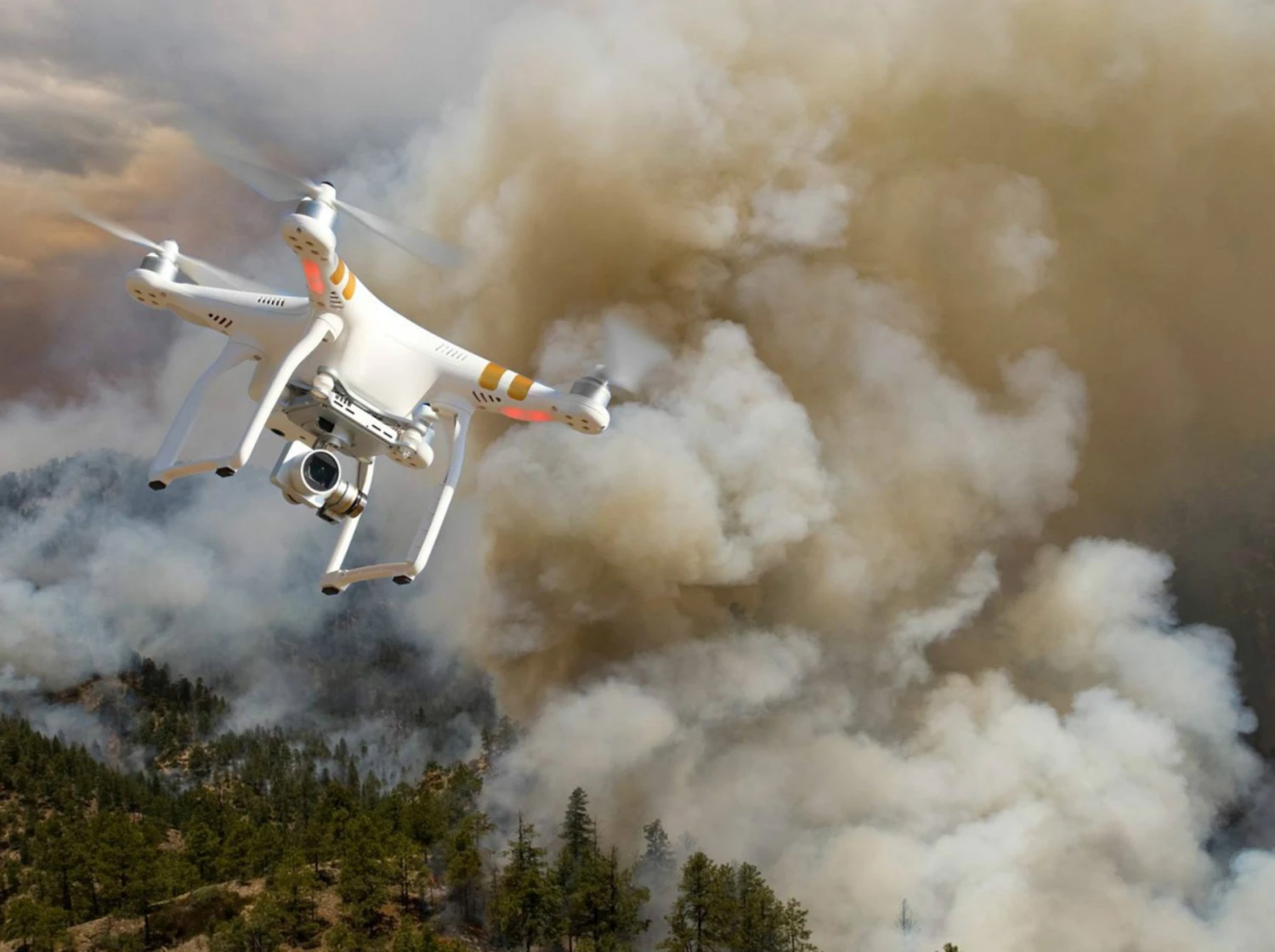
FireSat fills a crucial gap: detecting fires in remote or mountainous areas where traditional aircraft-based surveillance is difficult or impossible. It also offers a much-needed early warning system that could potentially prevent catastrophic blazes from ever reaching full force.
Google.org helped kickstart the project with $13 million in funding in 2024, empowering the Earth Fire Alliance to lead its development. Google’s AI division built specialized infrared sensors, tested over controlled burns to train the AI system to distinguish real fire signals from false positives—like misaligned pixels or sensor noise.
In one early test, the satellite picked up a lit barbecue in a suburban backyard—demonstrating the sensitivity of the system.
Climate and Crisis: A Dual-Purpose Tool
Beyond emergency response, FireSat also supports climate research. The data collected will build a global historical archive of wildfire activity, enabling scientists to better understand fire behavior, trends, and their connection to climate change.
“It’s more than just about detecting fires,” says Rothenberg. “It’s about reducing emissions and protecting ecosystems. FireSat is a powerful example of how AI can both respond to climate disasters and help prevent them.”
Toward a Smarter, Safer Future
As wildfires become more frequent and severe, the need for faster, smarter detection systems is urgent. FireSat offers a new way forward—one that blends space technology, AI, and climate science to deliver life-saving insights in real time.
With dozens more satellites planned, Google’s FireSat constellation could soon become a global safety net, spotting danger before disaster strikes and reshaping how the world fights wildfires.